


SitePlan app for iPhone and iPad
Developer: SitePlan GmbH
First release : 16 Mar 2020
App size: 174.12 Mb
Digital Navigation for the construction, planning and maintenance of infrastructure projects.
Built for project teams: GPS navigation in construction plans and satellite map with georeferenced photos, centimeter-accurate measurement, as-built documentation and collaboration.
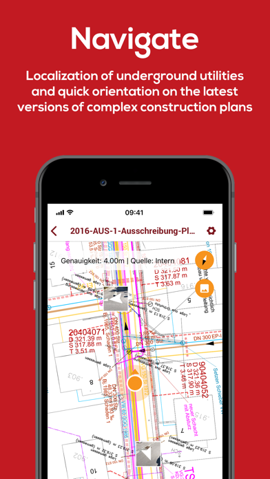
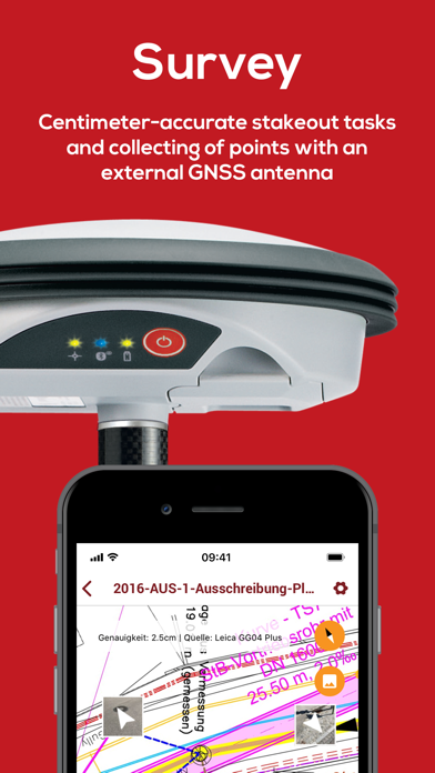
SitePlan enables project teams to navigate PDF plans and a satellite map with their phone GPS. The plans are simply converted into digital GPS maps. Photos taken are also automatically located with their geoposition on the plans and on the map. In addition, each project member can easily connect to GNSS smart antennas, which enables positioning to the centimeter. This makes staking out, centimeter-accurate as-built documentation and digital field measurements a breeze. All data such as plans and photos are available to the entire project team in real time.
This enables you to:
- See your position on the construction plan and on the satellite map for better orientation
- Easily localize plan objects such as lines, e.g. to avoid line damage
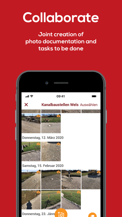
- Immediately locate construction site photos automatically with GPS
- Manage all construction plans digitally
- Create conclusive photo reports including location information with just a few clicks
Our customers appreciate our app primarily because of:
- the simple localization of plan objects (e.g. lines) and the avoidance of line damage
- the simple documentation of the construction progress with GPS photos
- the much better orientation on the construction site through GPS
- the elimination of time-consuming measuring work using tapes and strings
- the elimination of time-consuming field measurements using sheets and a wheel
- Centimeter-accurate documentation of construction work and local conditions such as lines and pipes